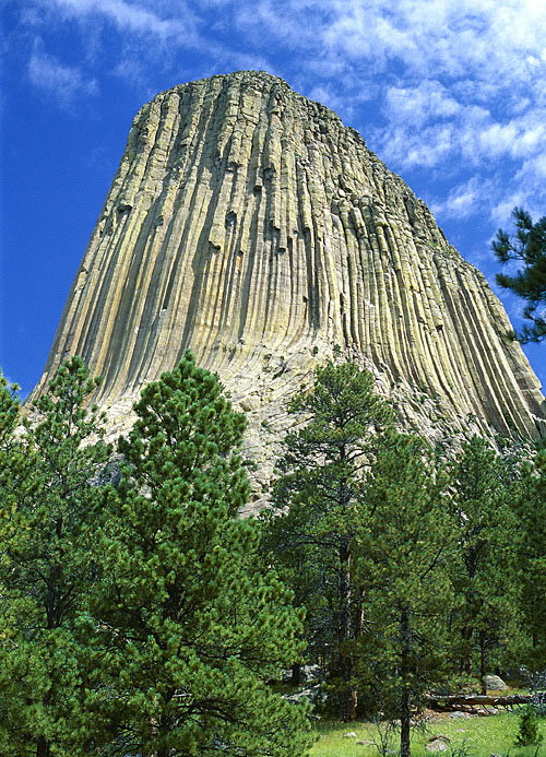
 Devils Tower National Monument in red state Wyoming holds numerous distinctions. Foremost, it is America’s first declared national monument. In some directions, the Tower is visible by vehicle for nearly 50 miles; some say even farther. Native American tribes continue to share a reverence for the monument through their sacred narratives and folklore. And as many as 6,000 climbers worldwide arrive at the Tower each year to scale its walls. Still, one of the unusual credits to the monument’s renown rests in film history. Devils Tower played a key role as a mashed-potato sculpture in the alien thriller Close Encounters of the Third Kind (1977).
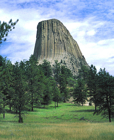
Devils Tower, a remarkable mass of protruding molten rock, lies in the Black Hills of northeastern Wyoming. The formation has a base diameter of 1,000 feet and rises 867 feet from its base; 1,267 feet above the Belle Forche River; and 5,112 feet above sea level. The Tower’s base circumference is one mile. Its summit, slightly dome shaped, is about one-and-a-half acres or the size of a football field. The terrain at the top is rocky, with native grasses, cactus, and sagebrush. Chipmunks, mice, pack rats, and the occasional snake are native to the summit.
Massive columns flute the sides of Devils Tower, giving the tower the appearance of a bundle of huge pencils held together by gravity. More than 200 routes have been accessed to climb the Tower via these distinct columns. Near the summit the columns round in, and at the base they flare out. The whole formation rests on a platform of buff sandstone. The Tower’s rock composition is phonolite porphyry, similar to granite but lacking the quartz element. The geological structure of Devils Tower affords many perspectives. Appreciate its myriad of faces and observe its richness!
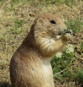 Wildlife Protection at Devils Tower Always a Key Objective
The more than 1,300 acres surrounding Devils Tower features its own attractions, too, beginning with the general landscape. It’s a panorama of ponderosa pine forests merging into grassland plains and a home to more than 150 species of birds. These include hawks, bald and golden eagles, prairie falcons, turkey vultures, American kestrels, mountain bluebirds, nuthatches, and black-billed magpies. Two mammals dominate the Tower surroundings — white-tailed deer and black-tailed prairie dogs. You might say it’s a spectator sport watching the playful prairie dogs in their grasslands “town.” The deer, while not tame, are quite accepting of visitors to the monument. They are often visible within 10 or 15 feet of the wooded trails or resting on the grassy hillsides.
Wildlife has been protected at Devils Tower since 1906 when President Theodore Roosevelt proclaimed the site as the first national monument under the new Antiquities Act. During the Great Depression, the Civilian Conservation Corps built road improvements and camping and picnicking facilities. They constructed a roughhewn log museum, too, which still serves today as a visitor center, bookstore, and registration office for climbers.
Some climbing routes are annually closed to protect nesting prairie or peregrine falcons. The Tower’s exposed rocky terrain provides ideal habitats for their eyries. Park staff monitor this nesting activity, generally between March and July. Routes reopen when there is no observable nesting activity. The reasons for route closures are clear. Climbing near nests stresses the birds and often leads to the death of fledgling newborn. Equally important, defensive raptor behavior is potentially dangerous for climbers. Always check for route closures when you register to climb as the park rangers will strictly enforce these closures. For instance, as of April 1, 2019, the west face of the Tower is closed to climbing.
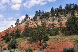 Popular Hiking Trails at Devils Tower
Aside from recreational climbing and camping, hiking is the popular activity among the Tower’s 500,000 annual visitors. Although limited in quantity, the quality of the five park trails makes hiking a memorable experience:
• Tower Trail (1.3 miles), the most frequently hiked, starts across the parking area from the visitor center. A short, steep section leads to you a junction that you can take either way to walk around the base of the Tower. The paved trail leads through a pine forest and the boulder field. Interpretative signs explain some of the geology and ecology of the monument.
• Red Beds Trail (2.8 miles) is more traditional, offering expanded views of the Tower and the surrounding Belle Fourche River valley. You can access this trail from the visitor center parking area or connect to it from one of the other park trails.
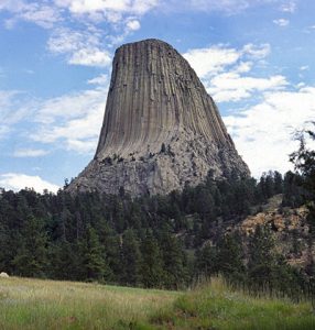 • Joyner Ridge Trail (1.5 miles) follows the Joyner Ridge foothills and provides exceptional Tower outlooks, especially around sunset. This trail begins by taking a dirt road from the main park as you enter or leave the visitor center. A half-mile connector trail links Joyner Ridge with Red Beds. The trail’s east end has a stark elevation change, dropping from or climbing to the ridge depending on your direction.
• South Side and Valley View Trails (1.5 miles total) start from the park amphitheater and proceed through the prairie dog town to join the Red Beds Trail.
If you hike the Tower Trail, you may notice cloths or small bundles attached to the trees. These are Native American prayer cloths and represent the spiritual connection many tribes have with the Tower. Park officials ask that you do not touch, disturb, or remove these prayer cloths. Some consider it culturally insensitive to photograph these sacred postings.
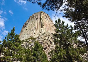 The Naming of a National Monument
As you might expect, everyone is interested in how Devils Tower got its name. To start, the monument is a sacred place to more than 20 Native American tribes. To the Lakota, the Tower is commonly known as Mato Tipila (Bear Lodge). The Lakota constellation Mato Tipila is a slightly leaning rectangle. When the constellation rises in the night sky, it’s on its side. But as it sets, it falls perpendicular to the horizon, mirroring the shape of the Tower. Other tribal names for the Tower are Bear’s Tipi, Home of the Bear, Tree Rock, and Great Gray Horn. It’s no coincidence, either, that Ursa Major (the Great Bear) is one of many constellations visible from the Tower. Oral histories about the night sky often address tribal reverence for the Milky Way, the North Star, and Orion’s Belt.
The earliest official maps of the Black Hills area labeled the Tower as Bear Lodge, the direct translation of the Lakota name. Later maps altered the formation’s identity. Park historians point out that today’s name “Devils Tower” originated during an 1875 scientific expedition, escorted by Army Col. Richard Dodge. Among his duties, Dodge was to survey the area, which had confirmed reports of gold deposits. Dodge wrote that “the Indians call the shaft ‘Bad God’s Tower’.” In his personal log, he interpreted that label to be “Devil’s Tower.”
Some historians contend that Col. Dodge simply received a bad translation of the indigenous name; others say it was an intentional renaming. Undoubtedly, the actual truth is lost to history. When the site was declared as the first national monument in 1906, Devils Tower was the designation, and so that name became official. In case you’re wondering, a simple clerical error dropped the possessive apostrophe, leaving the name as Devils Tower.
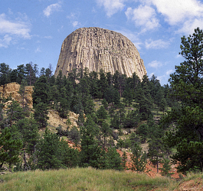 Geologic Theories Behind the Creation of the Tower
Not all geologic formations are created equal. In the late 19th century, science always had an explanation for every natural occurrence, or so it thought. Initially, Devils Tower was considered to be the core of an ancient volcano. It probably isn’t. Yes, the Tower does appear as if it were volcanically thrust up through the ground. But this dramatic element is actually the result of abiding erosion. Although the geologic theories of the Tower differ slightly, the concept of erosion exposing the Tower is widely accepted.
Overall, most geologists agree that Devils Tower began as magma or molten rock buried beneath the Earth’s surface. Where they disagree are the processes by which the magma cooled to form the Tower. The simplest explanation is that about 50 million years ago, molten magma forced its way into overlying sedimentary rocks and then cooled. The cooling igneous rock then contracted, fracturing into columns. Earlier, another magma flow formed today’s Little Missouri Buttes. Over millions of years, the sedimentary rock eroded to expose Devils Tower and accentuate Little Missouri Buttes.
Another formation theory contends that the Tower is a remnant of a laccolith. A laccolith is a large mass of igneous rock, typically lens-shaped, which intrudes between layers of sedimentary rock without reaching the surface. This causes the sedimentary layers to uplift in the shape of a dome. A different theory points to Devils Tower as a volcanic plug or the neck of an extinct volcano. However, there is no supporting evidence for volcanic activity in the region. Still another hypothesis suggests the Tower was once a crater formed by underground steam. The crater then filled with lava, cooled, and solidified into a dome structure. Erosion wore away parts of the dome to create the Tower as seen today.
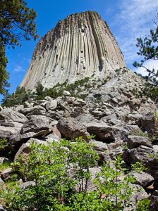 Respectful Climbing at a Sacred Site
Although climbing Devils Tower is a recognized past time, the activity is not universally accepted. Native Americans regard the Tower as sacred, with some expressing concerns about recreational climbing. Some tribal members perceive the activity as a show of disrespect for Native American culture or desecration of a sacred site. To hone a cultural balance, the National Park Service advocates a voluntary climbing moratorium during the month of June. This is a culturally significant time when many, though not all, ceremonies traditionally occur. The voluntary June closure has been very successful — resulting in an 80 percent reduction in climbing activity.
Traditionally, Devils Tower boasts a climbing history that dates back to July 4, 1893. In front of more than 1,000 spectators, two ranchers, William Rogers and Willard Ripley, made the first ascent. They used a special wooden ladder built earlier that spring for the first 350 feet of their climb. Tower climbs are on record since 1937. Today, contemporary rock climbers leave little trace of their ascent. They rely solely on their physical strength in order to make a climb. Also, the modern technical equipment used today is more safe and efficient, removable, and non-damaging to rock surfaces. Pitons, the steel “pegs” once popular with traditional climbing (hammered into cracks), see little use these days in modern climbing techniques.
The time necessary to ascend Devils Tower depends on skill, route difficulty, and the number of climbers in the group. For example, the average time for two climbers to use the Durrance Route ranges from four to six hours. It takes about one to two hours to rappel down. The fastest climb on record is from the 1980s. Todd Skinner, a Wyoming native, climbed alone without ropes or protection in 18 minutes using the Walt Bailey route.
 Park Admission Fees and Passes
Devils Tower National Monument is open year-round, 24 hours a day, seven days a week. The visitor center is open daily (9:00 a.m. to 5:00 p.m.) during spring, summer, and fall. However, during summertime peak hours, the park often experiences maximum parking capacity for several hours every day. Also, parking procedures change during the Sturgis Motorcycle Rally, an annual event held during the first full week of August. Currently, the following entrance fees are in effect:
Vehicle Pass ($25 for one to seven days): single, private, noncommercial vehicle and all its passengers.
Motorcycle Pass ($20 for one to seven days): single motorcycle and operator/passenger.
Individual Permit ($15 for one to seven days): one individual entering on foot or bicycle; individuals 15 years of age or younger admitted free.
The cost of commercial tours ranges from $25 to $100. It is based on the seating capacity of the commercial tour vehicle, not the actual number of passengers.
Standard and special entrance passes are available, too, including:
Devils Tower National Monument Annual Pass ($45/valid for 12 months from date of purchase).
America the Beautiful (National Parks and Federal Recreational Lands Pass) Annual Pass ($80/valid for 12 months from date of purchase).
American the Beautiful (National Parks and Federal Recreation Lands Pass) Lifetime Senior Pass ($80/valid for lifetime from date of purchase).
America the Beautiful (National Parks and Federal Recreational Lands Pass) Annual Senior Pass ($20/valid for 12 months from date of purchase).
America the Beautiful (National Parks and Federal Recreational Lands Pass) Lifetime Access Pass ($0/valid for lifetime for U.S. citizens or permanent residents with permanent disabilities).
Belle Fourche River Campground
The Belle Fourche River Campground is open May through October, weather permitting. It is a two-loop, 46-site campground with four accessible sites and three tent-only group sites. Drinking water is available at water spigots and in the restrooms. Large cottonwood trees provide shade, and a picnic shelter and tables are available north of the campground. This is a first-come, first-served campground, with no reservations. There is a 14-day limit on occupancy, with overflow parking in the nearby picnic area. And there are 43 pull-through sites with room for recreational vehicles up to 35 feet, but no hookups are available.
Individual sites ($20) can accommodate up to eight people. Each site permits a maximum of two vehicles (or four motorcycles). Group sites ($30) can accommodate up to 20 people per site. Each site permits a maximum of four vehicles. Accessible sites ($20) are A-2, A-4, B-11, and B-25. Each site can accommodate up to eight people. Each site permits a maximum of two vehicles (or four motorcycles).
In Wyoming, the entrance to Devils Tower National Monument is 33 miles northeast of Moorcroft and 27 miles northwest of Sundance via U.S. 14. In South Dakota, you access the park 52 miles southwest of Belle Fourche via S.D. 34/Wyo. 24.
For further information regarding other scenic destinations in Wyoming and other parts of the West, visit here.